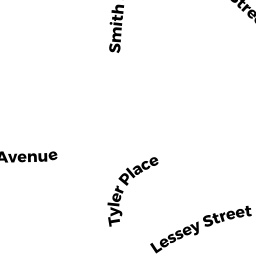
22 LESSEY ST
Owner Information
AMHERST CLARK HOUSE LP
22 LESSEY ST #607
AMHERST, MA 01002


Property Details
22 LESSEY ST is classified as a Use code not known or nor provided. (Apartments).
The primary structure on this property was built in 1978. There are 110,320ft2 of built area within this property. There is 94,560ft2 of residential/living space within this property.
22 LESSEY ST is valued at $11,713,100. The land is valued at $667,100 and the structures are valued at $10,611,200. There is an additional valuation of $434,800 on this property.
This property is in Zone RG10. Confirm with local Zoning Board authorities to ensure there are no overlays or other easements on this property.
The most recent deed for 22 LESSEY ST is recorded at the local registrar in Book 12580, Page 0088. 22 LESSEY ST was last sold on Friday, March 24, 2017 for $12,500,000.
Assessment data from fiscal year 2022.
Flood Data
According to the FEMA National Flood Hazard Layer, this property does not appear to be in a flood zone. It may also be in an area not yet reviewed. Nonetheless, confirm this information prior to taking any action.
To view the flood hazards around this property, create a FEMA "Firmette" Map of the area around 22 LESSEY ST.
Broadband Internet Providers
| Provider | Type | Bandwidth (mbps) | |
|---|---|---|---|
| HughesNet | Satellite | 25 | 3 |
| VSAT Systems, LLC. | Satellite | 2 | 1 |
| Comcast | Cable | 1000 | 35 |
| PAETEC Communications, Inc | DSL | 0 | 0 |
| T-Mobile | Fixed Wireless | 25 | 3 |
| GCI Communication Corp. | Satellite | 0 | 0 |
| Viasat Inc | Satellite | 100 | 3 |
| Verizon New England Inc. | DSL | 15 | 1 |
Broadband service provider data from December 2020.
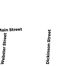
Adjacent Properties
- KELLOGG AVE
Vacant, Selectmen or City Council (Municipal) owned by TOWN OF AMHERST (INHABITANTS) - 33 KELLOGG AVE
Hsg Auth C owned by AMHERST HOUSING AUTHORITY - 16 TYLER PL
Two-Family Residential owned by RPF LLC - 10 TYLER PL
Three-Family Residential owned by ROCKY HILL RD PARTNERS LLC - 38 LESSEY ST
Single Family Residential owned by MCLAREN MARGARET J LIFE ESTATE - 30-30 BOLTWOOD WALK
Other, Open Space owned by None - 30 BOLTWOOD WALK #1
Retail Condo owned by DOWNSTAIRS LLC - 30 BOLTWOOD WALK #2
Office Condo owned by FARBER, BODZIN LLC - 30 BOLTWOOD WALK #3
Retail Condo owned by THE BOLTWOOD GROUP LLC - 30 BOLTWOOD WALK #4
Office Condo owned by CARSP REALTY INC - 30 BOLTWOOD WALK #5
Use code not known or nor provided. owned by SLATER, JONATHAN & OLGA - 51 BOLTWOOD WALK
Municpal C owned by TOWN OF AMHERST INHABITANTS - 70 BOLTWOOD WALK
Municpal C owned by TOWN OF AMHERST (INHABITANTS)